My Maps to Visually Document and Tell Stories
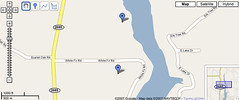
 Blogical Minds, a 5th grade teacher's blog for working with her students, a post asks how to use Google Maps in the classroom. She has her students using it to document commenters to their classroom blogs. What a neat idea! It creates a lot of geography mini lessons that would not exist otherwise with maybe a little history thrown in. She then asks for more ideas. I offered the following in the comments just in case you are interested. I see ties to digital storytelling and science here as well as the aforementioned geography and history.
Folks are already creating some neat My Maps that they are sharing:
Hosting Olympics CitiesEvery Major League Baseball Park and HOF
Our Earth as Art (sat images)
America's Highway: Oral Histories of Route 66
Of course there are even more to look at. One idea I would like to elaborate on (for my memory if nothing else) is that you can zoom in rather closely in Google Maps. It would allow our science students to document the findings of our wetlands project location with pictures and descriptions using coordinates. I am sure the Texas Parks and Wildlife group would love to have that. I just need to get them some GPS handhelds now to help with that.
It would also be a great addition to our school website where potential visitors and home buyers can virtually visit our campus and see what grades are where and which facilities are which. If we really want to take it one step further, we could label classrooms by teacher or subject and contact info.
If you are logged into your Google account, then just click on the maps link on the Google home page just above the search window. It will open Google Maps with a new tab added on the left called My Maps. It is pretty simple to do. Find Google's directions here. Please come back and share what you create. I will post mine when we return from Florida. My son is going to have an awesome "My Summer Vacation" report to share with his class next year.
And the best thing about it all is that it is another FREE tool to use with our students.
Technorati Tags: google_maps, Scott_S_Floyd, TXBWP, my_maps, science, art, geography, digital_story_telling
Powered by ScribeFire.

